“Autonomous Infrastructures” is an urban model for localized energy production in the context of extreme climatic conditions.
The model looks into the possibility of implementing alternative energy processes (namely waste-to-energy and photocells) on a neighborhood scale. Moreover, the model investigates the use of passive design techniques ranging from courtyard houses to large compact morphology neighborhoods in the ultimate aim of lowering energy consumption and altering the daily social practices of the urban dwellers.

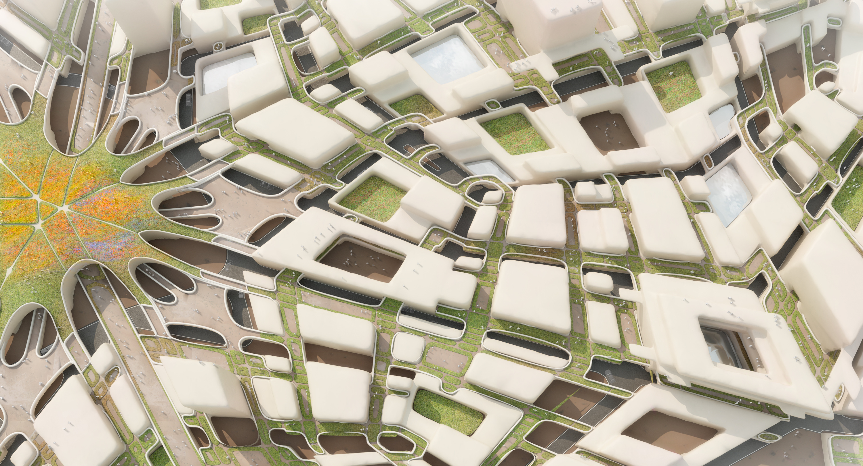

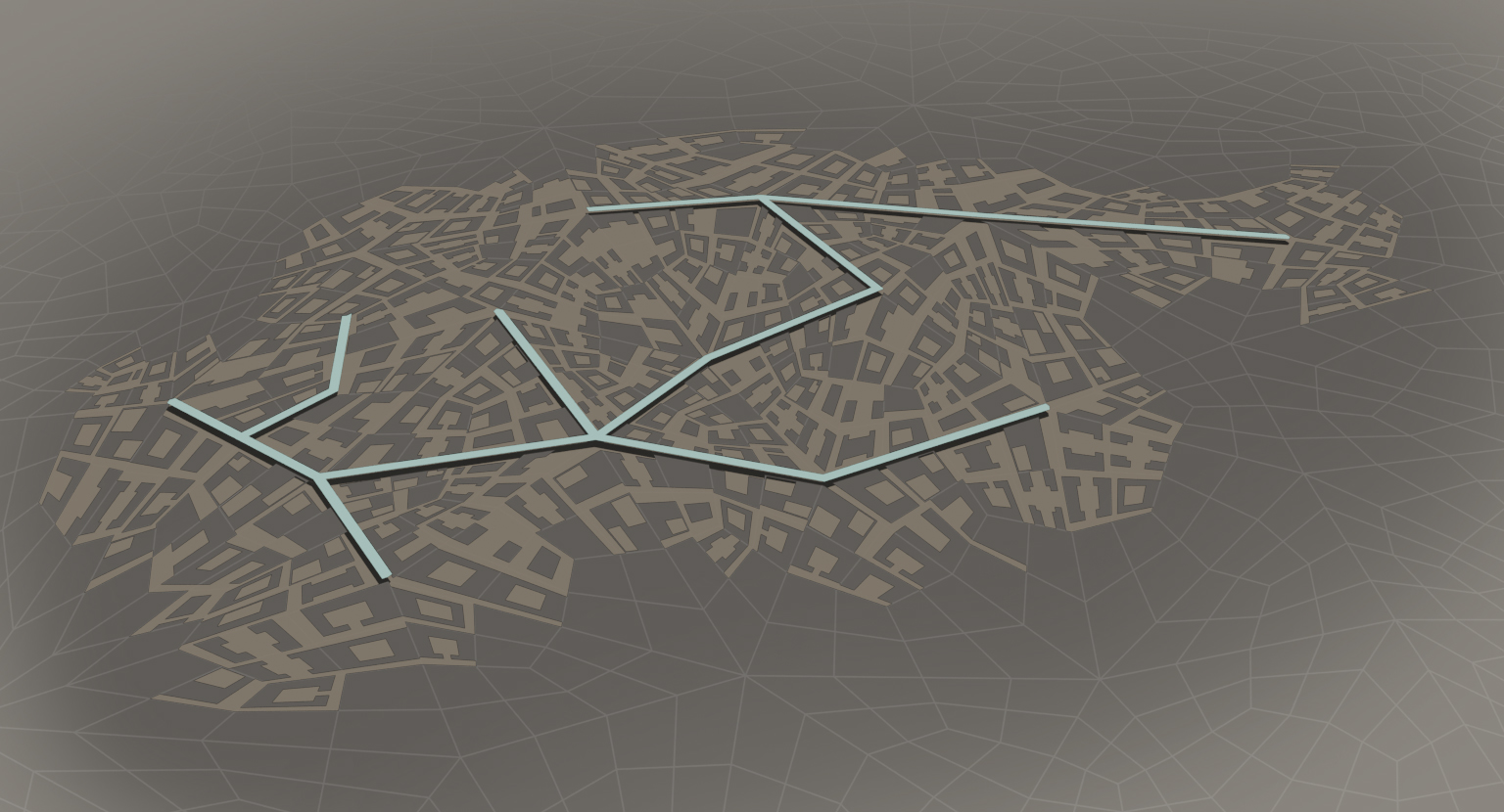
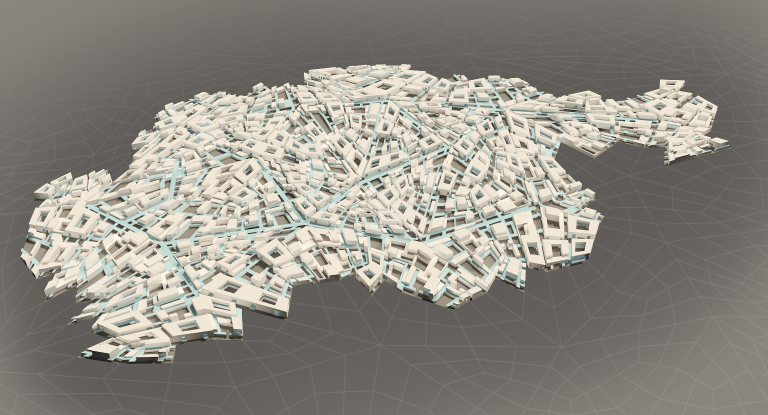
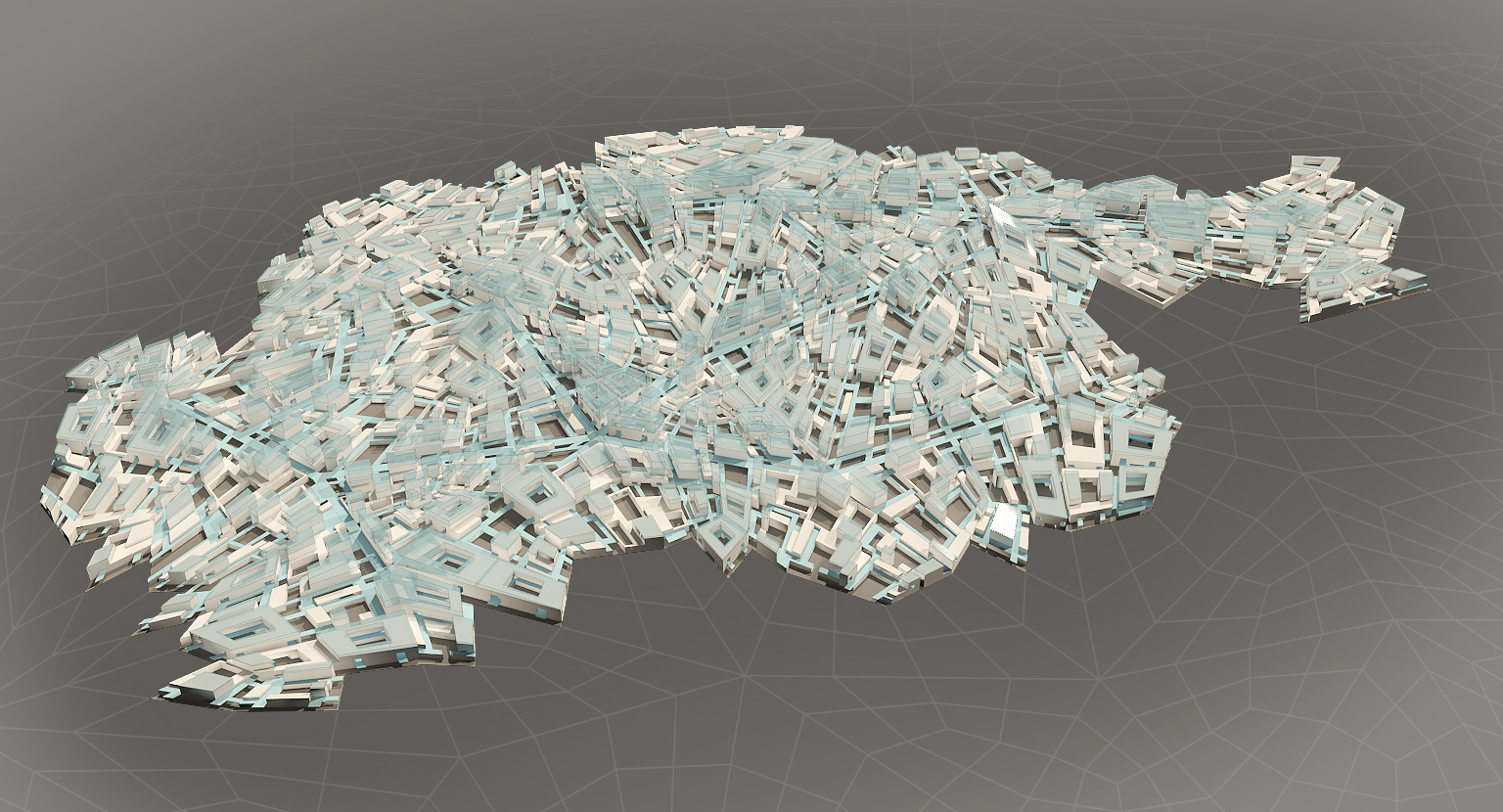
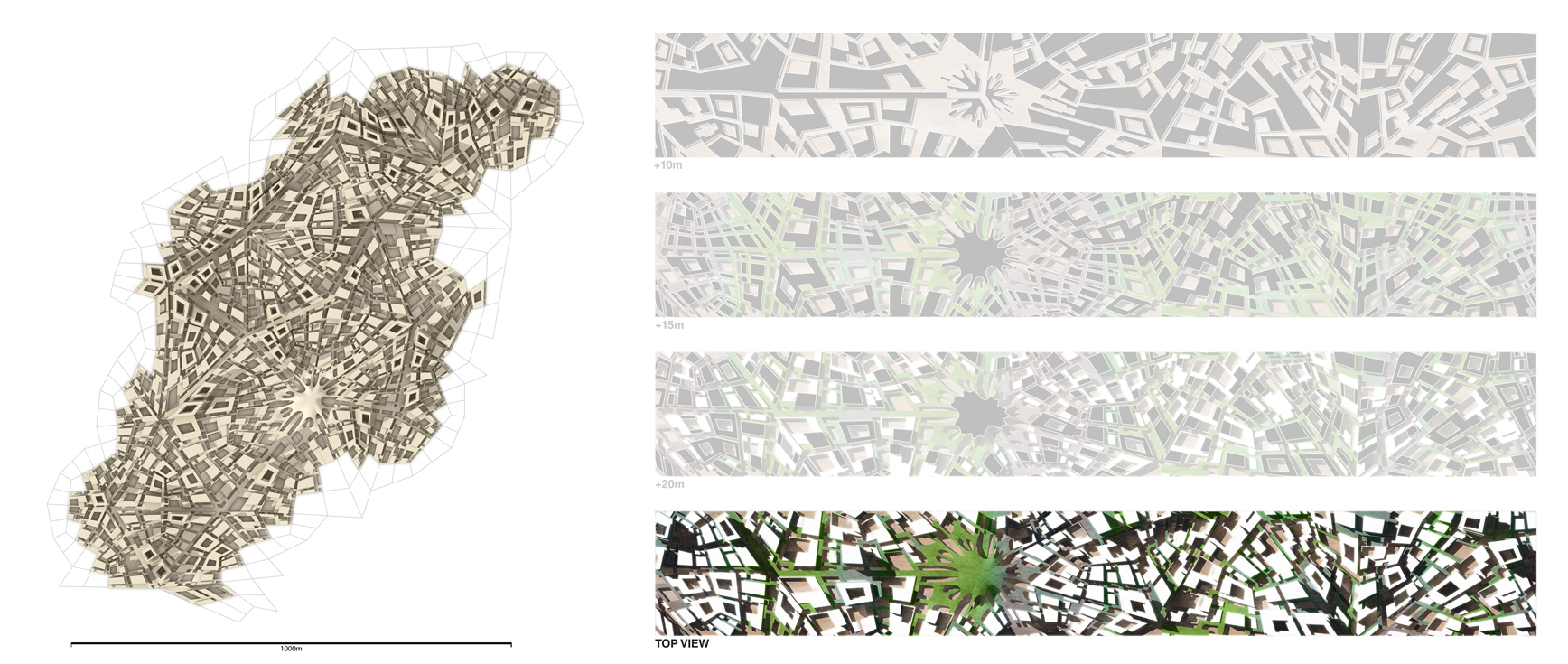
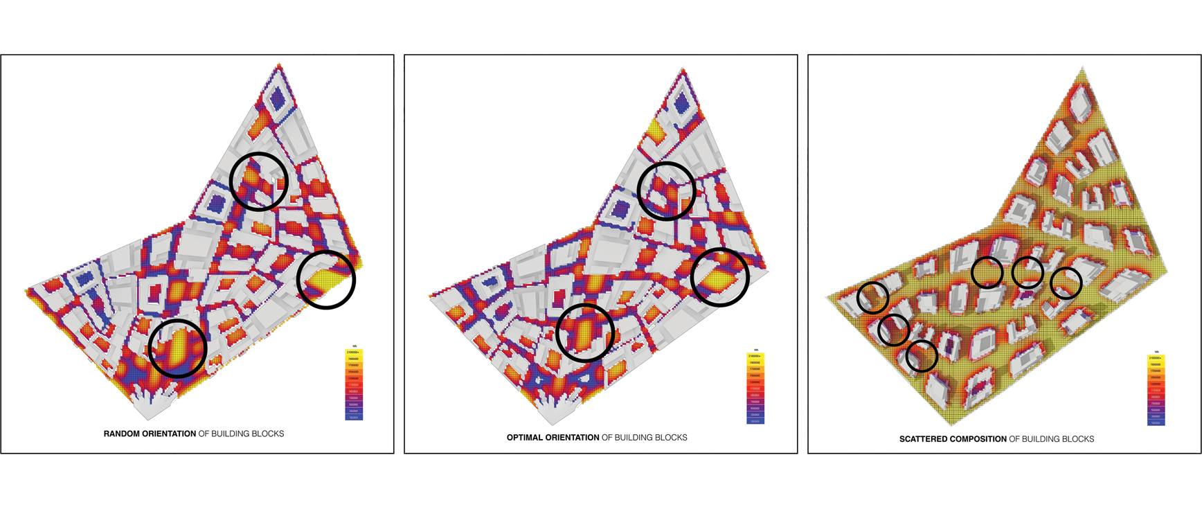
An algorithmic approach is devised to allow the emergence of a climate-responsive tissue, optimized for ground floor shading and solar exposure reduction of building facades. The lots are generated on the basis of the travel distance for waste trucks. Once the model is fully populated and the target density is reached, a series of measurements of the generated urban tissue are achieved using Ecotect to evaluate the overall efficiency of the system. The project also includes a three-dimensional print of the final urban patch displaying the porosity of the created pattern.

The generated model is able to satisfy up to 47% of the total need in energy from solar power (39%) and organic waste (8%). With the aid of passive design, energy consumption can be lowered by 5%, increasing the autonomy level of the system to 52% solely from local architecture and renewable resources. The 5% of passive energy reduction rely solely on courtyard typology. The ability of the urban tissue to provide constant shading throughout long periods of the day is largely due to its physical characteristics and in particular to the proportions of its courtyards and public spaces.
 Solar Rooftops -- Table:
The blocks are organized into three main classes: residential, offices and mixed use. The principle guidelines for developing those classes are the creation of micro-climatic conditions and the bridging of different blocks. The ratio of rooftop area to footprint area is calculated, providing a measure of the energy that can be harnessed from photo-voltaic roofs. The typologies introduce a new layer for public interaction elevated from the ground floor (highlighted in blue).
Detailed measurements of the amount of daily solar radiation absorbed by various internal courtyards show that the deeper the courtyard is, the smaller the amount of heat it absorbs. The orientation of courtyards constitutes an important factor in the passive reduction of solar gains. Despite the fact that it doesn't considerably affect heat gains, the orientation of urban blocks plays an important role in providing cross-ventilation through the interior spaces of the dwellings.
Urban Generation Algorithm
This video shows the algorithm that is used to populate the base mesh. The way this one works is by looping through the lots and evaluating each in terms of their shape and programme. The allocation of building blocks onto the appropriate quads of the base mesh requires a gathering of all the available data regarding urban morphology. The algorithm tests the performance of each block in its four different orientations and selects the one that allows for maximum shading on the ground floor and minimum exposure to the sun.
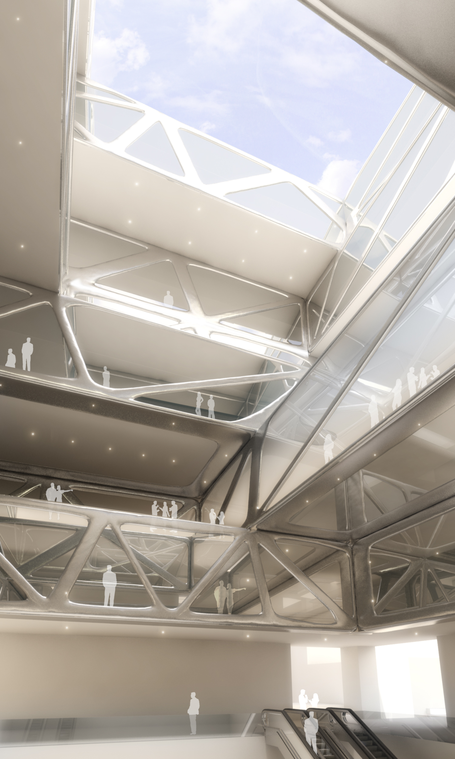
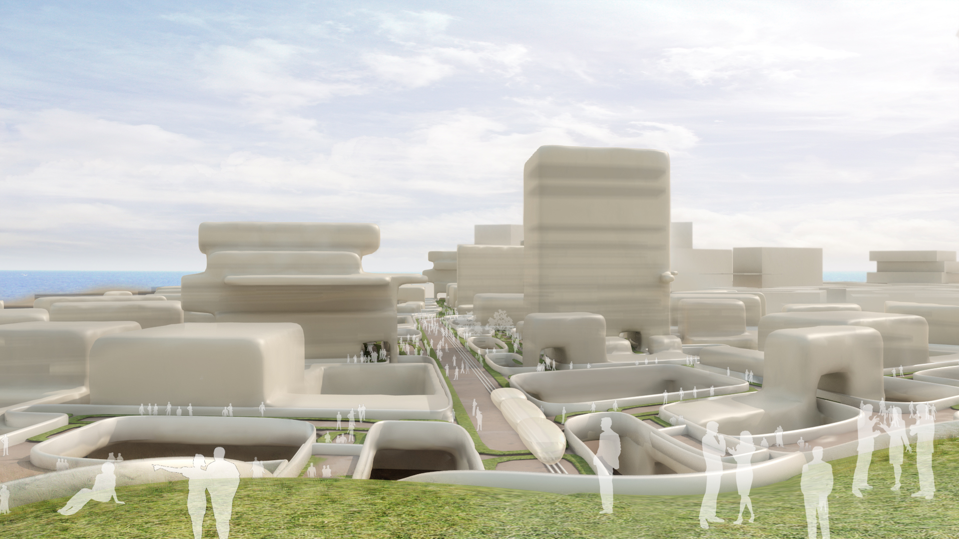
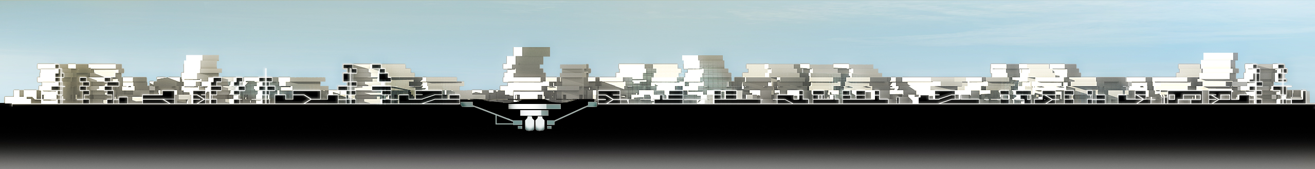
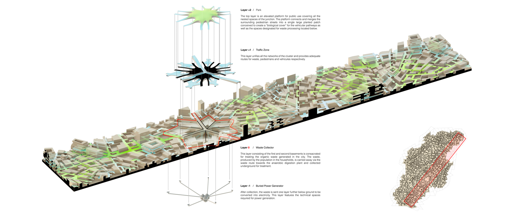
The urban tissue consists of multiple interconnected layers of infrastructure. On the ground floor, the waste route and open spaces are laid out and linked to the waste outlets of the building blocks. The waste routes are covered by avenues of large pedestrian flow and accommodate for mass transit circulation. On the second floor, the city consists of an elevated network of public spaces and streets that penetrate the buildings in a variety of ways. The two main layers of the urban fabric connect inside the buildings by the means of public ramps and staircases.
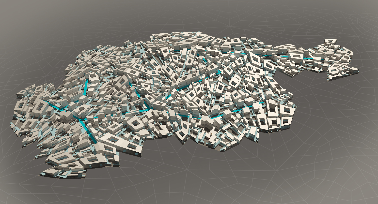
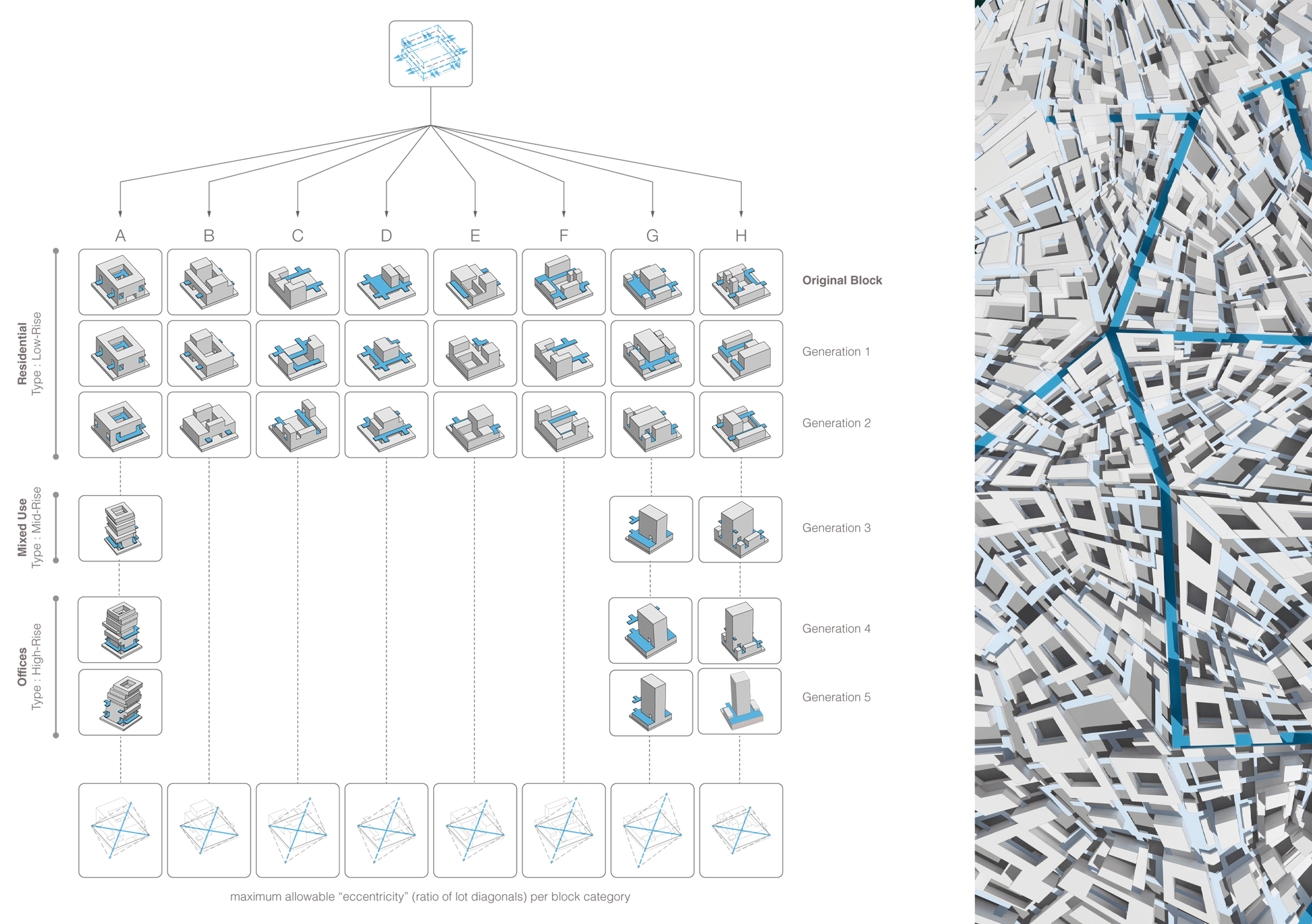
Among all the properties of the designed blocks, the edge condition is the most crucial as it dictates the way each one of the 33 types interacts with its four neighbors when allocated to a specific lot on site. Each block is allowed to connect with its four neighbors at two levels: the ground floor and second floor. It is important to note that a number of these blocks are purposely designed in order not to satisfy either condition on some of their edges. The aim behind this is to vary the interlocking condition of the blocks so as to allow certain ones to be stuck with each other and others to be spaced. Some blocks are designed to stitch, others to obliterate. For example, block D2 is designed in a way to connect on both levels with all four neighbors, and thus to create continuity in the urban tissue.
Since there are 33 blocks in total, with each having a maximum of 4 possible orientations, 4 neighbors, 4 common interfaces and 2 connecting levels, the permutations of the blocks are practically endless. The 33 blocks are used to populate the base mesh, creating a variety of spatial conditions. In order to control the spatial configuration of the blocks as they populate the mesh, a performance measure is used to define how much every block is capable of sustaining deformation. Blocks with small courtyards are likely to deform, whereas those with large courtyards have less chance to do so. This performance measure is called the “maximum eccentricity”. The polygons - more specifically, the quads - of the base mesh are evaluated using the ratio of their diagonals. A list of values ranging from 0 to 1 is obtained then used computationally to allocate the most appropriate types of blocks based on their allowable eccentricity or tendency to taper.
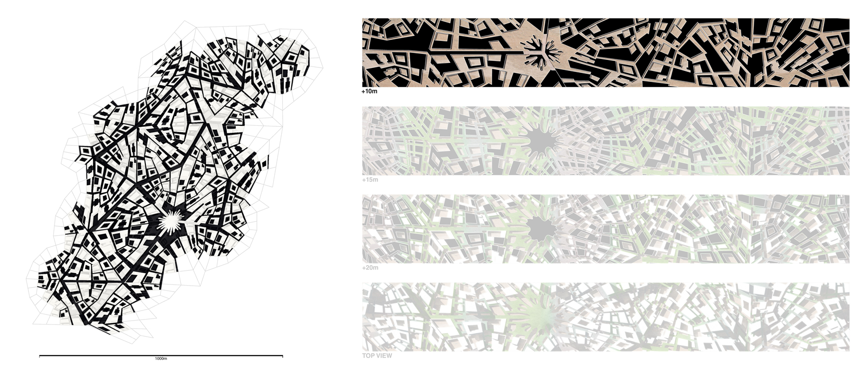
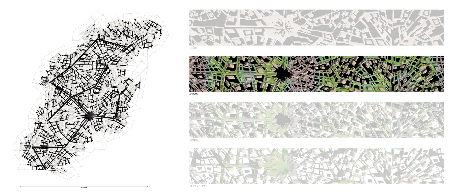
The arrangement of the block typologies produces emergent networks on the ground floor and second floor. Both networks are extracted from the urban fabric for evaluation. The ground floor is mainly used to provide vehicular as well as pedestrian passage throughout the tissue. On an abstract level, the network is represented by segments that preserve the direction of the streets. Due to the inherent properties of the fabric, not all the edges of the base mesh are covered by these segments, creating an uneven distribution of streets and an unevenly connected network. An axial analysis in Space Syntax shows that the portion of the network located near the waste plant to be the most integrated as it constitutes the innermost part of the fabric. Integration level also decreases the further the segments are from the center. Similarly, the elevated network, mainly designated for pedestrian circulation and bikes, is extracted to map out emergent public squares and analyse pedestrian flow throughout the cluster.

Architectural Association
Emergent Technologies & DesignFinal Dissertation
2013